
Optimal occlusion related viewpoint planning of terrestrial laser scanning
 © Hartmann
| Led by: | Jan Hartmann, Mohammad Omidalizarandi |
| Team: | Heshan Hao |
| Year: | 2023 |
| Duration: | 06/2023 – 12/2023 |
| Is Finished: | yes |
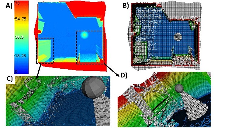
The completeness of an object survey by terrestrial laser scanners (TLS) is of decisive importance for the quality assessment. Due to possible occlusions, parts of the object cannot be recorded, which can lead to a loss of information. This can be solved by recording from multiple TLS viewpoints. Since a TLS measurement can take several minutes with high accuracy and resolution requirements, the number of possible viewpoints should be minimized as much as possible while maintaining a high level of completeness of the object recording. In this master thesis, a methodology for 3D viewpoint selection shall be developed and implemented, which minimize occlusion in the point cloud


