
Simulation and fusion of shallow water areas
| Led by: | Bahareh Mohammadivojdan, Frederic Hake |
| Team: | Rajesh Yadav Palaboina |
| Year: | 2023 |
| Duration: | Wintersemester 2022/2023 |
| Is Finished: | yes |
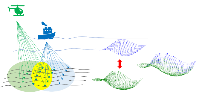
Bathymetry is the study of underwater topography of ocean floors, lakebeds and other water bodies. This data is often represented as bathymetry data which shows trenches, ridges, seamounts. Bathymetry of shallow waters represents the bathymetric data of the water areas with depths less than 50m. This data is collected using sonar and other remote sensing techniques.
Simulating bathymetric data involves using computer models to create a virtual representation of the underwater topography of an area. This can be useful when actual bathymetric data is not available, or when there is a need to predict how changes to the environment (such as sea level rise or erosion) may impact the underwater landscape.
Bathymetric data can be useful in shallow water areas, where traditional methods of measuring depth may be difficult or impractical. These techniques can be used to create detailed maps of underwater topography, which can be useful for a variety of purposes, including coastal engineering, resource management, and environmental monitoring.


