
Measurement system analysis and model-based sensor fusion for hydrographic water exchange zone monitoring using unmanned carrier systems
 © BfG
© BfG
| Led by: | Ingo Neumann, Hamza Alkhatib |
| Team: | Bahareh Mohammadivojdan, Frederic Hake |
| Year: | 2020 |
| Date: | 01-09-20 |
| Duration: | 09/2020 - 12/2023 |
Measurement system analysis and model-based sensor fusion for hydrographic water exchange zone monitoring using unmanned carrier systems
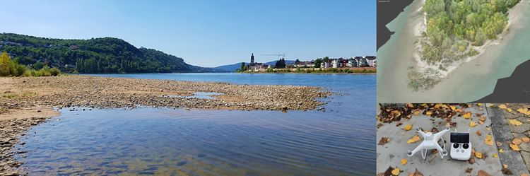
The aim of the project "Measurement system analysis and model-based sensor fusion for hydrographic water exchange zone monitoring with unmanned carrier systems (WaMUT)", which the GIH is working on on behalf of and in cooperation with the Bundesanstalt für Gewässerkunde (BfG) , is the continuous, quality-assured acquisition and modelling of geo-base data of the water exchange zones and shallow water areas of federal waterways to improve the quality of - in particular small-scale - digital terrain models of the watercourse. In contrast to the classic geodetic observation methods for recording bathymetry and topography, the use of unmanned sensor platforms - primarily on land (unmanned aerial vehicle UAV), but also on the water (unmanned surface vessel USV) - has come into focus in recent years. As part of the WaMUT project, these measurement systems are to be validated and, based on this, a quality-assured, integrated measurement programme is to be created in order to be able to record reliable geobase data in the water exchange zones.
The innovation of the research project is the development of a data fusion and an evaluation concept for classic measurement methods, so that an optimised concept for creating a digital terrain model and models for describing the stochastic properties of the measurement systems involved are available. An essential step in the project is the implementation of a (semi-) automatic (simulation-based) measurement planning tool, taking into account the (individual) uncertainties of all sensors.


