
ML and Modelling Underwater 3D Point Clouds
 © Mohammadivojdan
| Betreuung: | Bahareh Mohammadivojdan, Hamza Alkhatib |
| E-Mail: | mohammadivojdan@gih.uni-hannover.de |
| Jahr: | 2022 |
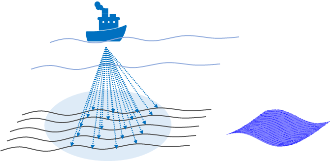
Mapping underwater areas, such as riverbeds, are the first steps of underwater exploration. Advancements of different methodologies such as range scanning methodologies, both optical and acoustic techniques, has provided the possibility to get high resolution information of these areas in the form of 3D point clouds. These high-density observations are also contaminated with noise and outliers. An optimal representation of such areas could be a mathematical model of the 3D points in form of a surface. In this master thesis we search for suitable machine learning base regression model. To mitigate the limitation one algorithm we want to investigate ensemble learning. This would help to combine predictions from two or more other models. The goal is to investigate the quality of such models in comparison to a B-spline model of the 3D point cloud.


